ACCESSIBILITY
- KEYBOARD NAVIGATION
- DISABLE ANIMATIONS
CONTRAST
- HIGH CONTRAST
- BLACK & WHITE CONTRAST
CONTENT
- INCREASE TEXT SIZE
- DECREASE TEXT SIZE
- MARK TITLES
- MARK LINKS
- UNDERLINE LINKS

Hiking Trails in Radovljica and its Surroundings

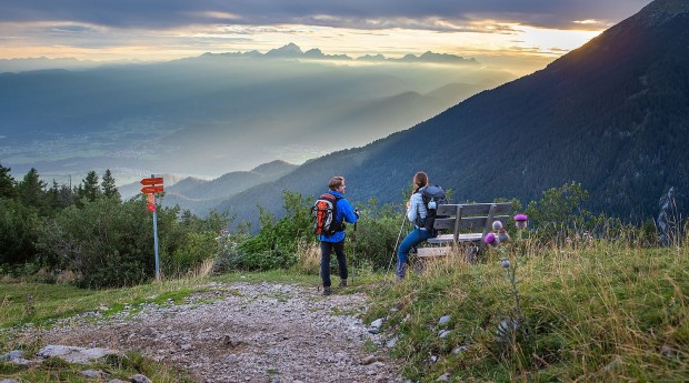
The most popular hiking trail in the Radol'ca area is undoubtedly the one that leads to the famous Roblekov dom mountain hut. In addition to 'Roblek', you can also hike to Dobrča, the Vodiška planina mountain pasture, Talež, Jamnik and on a network of other trails.
On hiking trails you will encounter stunning views and wonderful mountain pastures, where cattle graze in summer, and can sample some of the delicious, hearty food available in mountain huts. Two of the most scenic of the circular trails are the Shepherds' Trail, which leads from the Draga valley to the Preval mountain pasture then onwards beneath the slopes of Mt. Begunščica to reach the Roblekov dom mountain hut, and the trail around Kropa's mountains to the Vodiška planina mountain highland.
You can also reach the slopes of Mt. Begunščica from Ljubelj and the Završnica valley. From the latter, which is just a 15-minute drive from Radovlijca, you can hike up to the Stol, the highest peak in the Karavanke mountains, or to the peak of Vrtača, while the starting points for hikes to other peaks in the Karavanke mountains are also not far away.
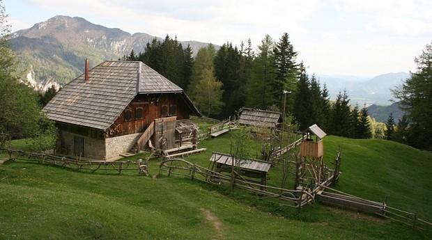
The Vodiška planina mountain pasture on the Jelovica plateau can be reached via a number of trails from Kropa, while there is also a path to the prominent church on Jamnik from where there are stunning panoramic views.
Radovljica's location in close proximity to the Gorenjska motorway enables easy access to Triglav National Park. You can set off to explore the park from several directions. The closest access points of the Pokljuka plateau and the Vrata valley, and Bohinj and Kranjska Gora are just a little further afield.
Two long-distance hiking trails run through the Radovljica area:
Slovenian Mountain Trail
The Slovenian Mountain Trail leads across the Karavanke mountains. Its course within the municipality of Radovljica runs from neighbouring Tržič up to Dobrča and from there to the Preval mountain highland and up to the peak of Veliki vrh on Mt. Begunščica. From there the trail descends via the Roblekov dom mountain hut before continuing towards Zelenica and onwards to Mt. Stol – the highest peak in the Karavanke mountains. There are control points at the Koča na Dobrči mountain hut, the mountain hut on the Preval mountain pasture, Mt. Begunščica, and the Roblekov dom mountain hut.
Juliana Trail Long-Distance Hiking Trail
The trail has been designed to traverse around Triglav National Park via hilltops with wonderful views and through quaint villages. It offers a combination of the natural and cultural heritage of the Julian Alps. Stage 4 of the Juliana Trail, which begins in Begunje na Gorenjskem, leads through the Radol'ca area. From there the trail leads across meadows and through rural villages to reach the old town centre of Radovljica and onwards alongside the Sava river to Bled.
Hiking trails in the surrounding of Radovljica:
The Vodiška planina mountain pasture (1,110 metres above sea-level)
Starting points: Kropa, Kamna Gorica, Jamnik
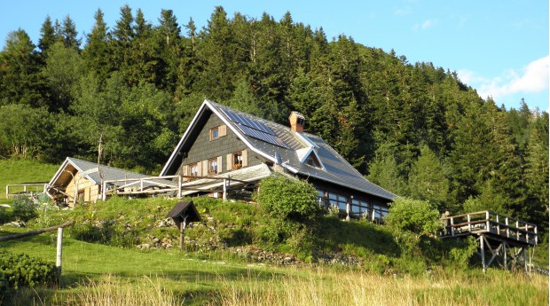
The Sankaška koča hut (839 metres above sea-level)
Starting points: The centre of Begunje, the Krpin Recreation Area
Theme path: St. Peter's Trail, Begunje
Planina Preval mountain pasture (1,311 metres above sea-level)
Starting points: The Draga Valley, Podljubelj
Planina Planinca mountain pasture (1,128 metres above sea-level) and Poljška planina mountain pasture (1,180 metres above sea-level)
Starting point: The Draga Valley
Roblekov dom mountain hut on Begunjščica (1,657 metres above sea-level) and the peak of Veliki vrh on Begunjščica (2,060 metres above sea-level)
Starting points: The Dolina Draga, Podljubelj
Theme path: The Shepherd's Trail, Begunje
Dobrča (1,634 metres above sea-level)
Starting points: Srednja vas, Hudi graben
Stol (2,236 metres above sea-level) and Vrtača (2,181 metres above sea-level)
Starting point: The Završnica valley
Golica (1,835 metres above sea-level)
Starting point: Javorniški Rovt
The Julian Alps (Triglav National Park)
Starting points: The Pokljuka Plateau (45 mins drive), Bohinj Lake (1 hour's drive), Mojstrana (45mins drive), Kranjska Gora (1 hour's drive)
Information about Triglav National Park: Triglavska roža Information Centre, Bled
Related news
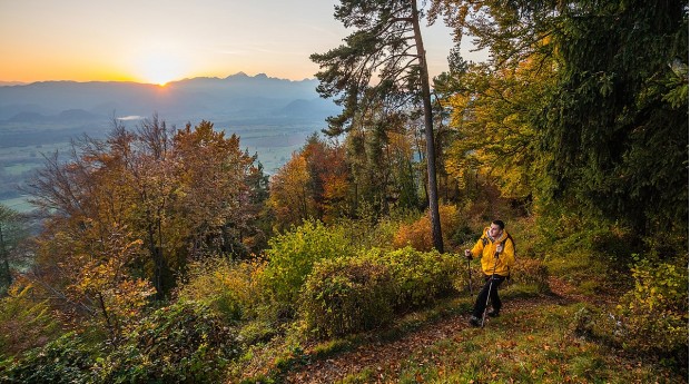
Over the panoramic 'čez Roža' trail to Roblek
The Begunje Shepherd's Trail is an excellent choice for seasoned hikers who are seeking great hiking with added stunning views. You can crown your ascent by adding on a climb to the peak of Veliki vrh on Mt. Begunščica.
Day trip from Radovljica
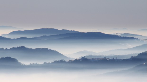
Triglav National Park, which is the only national park in Slovenia, is named after Slovenia's highest mountain. There are wonderful views of Mt. Triglav, which rises up right in the heart of the national park, from far and wide – including from Radovljica.
Inviting mountain pastures and peaks all year-round
The Karavanke await you with mountain pastures and the high peaks above them which offer superb views across Slovenia and Austrian Carinthia. Ascend them in summer or in winter.
